Victoria, Kansas
Maps
*
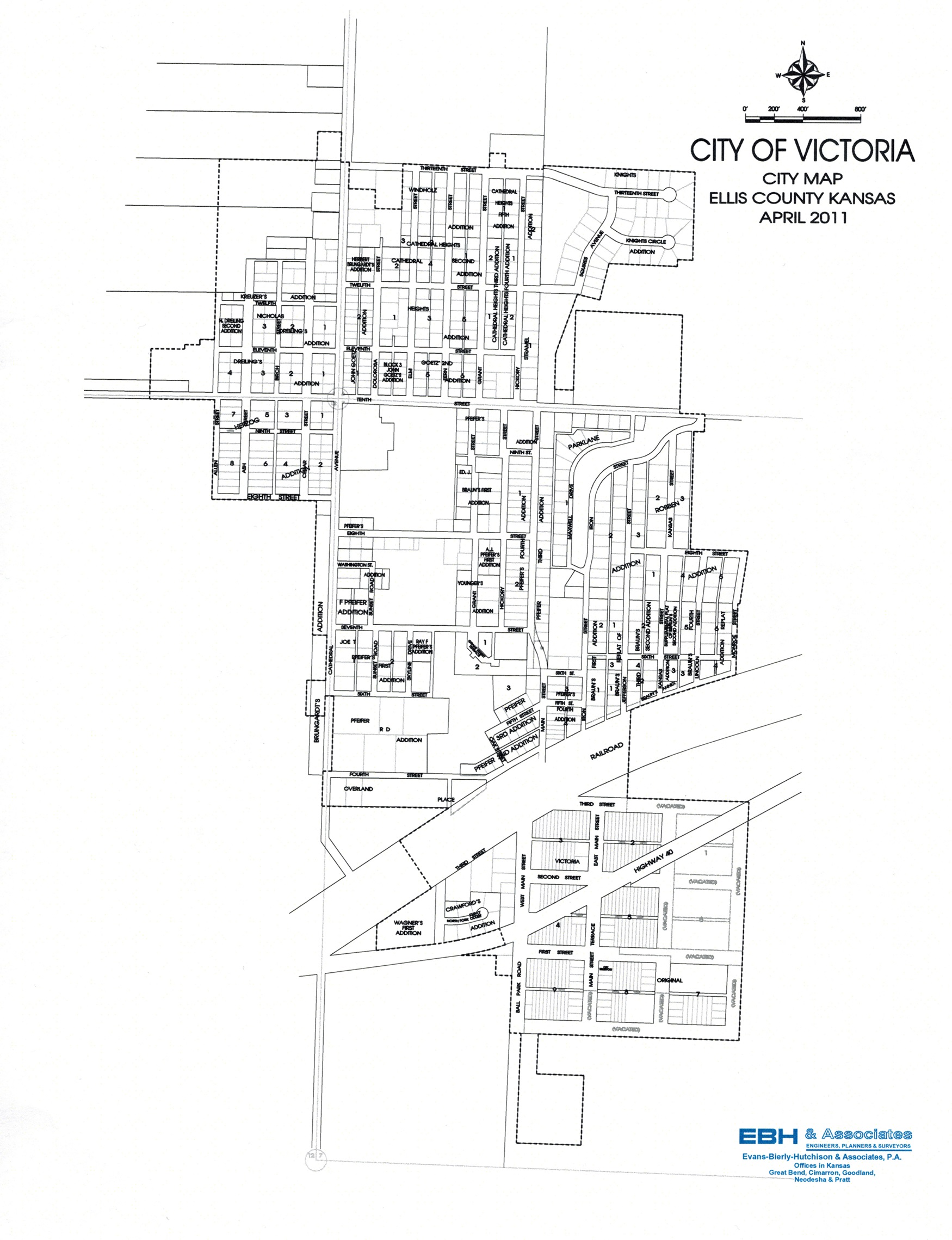
Map of Victoria (click to enlarge)
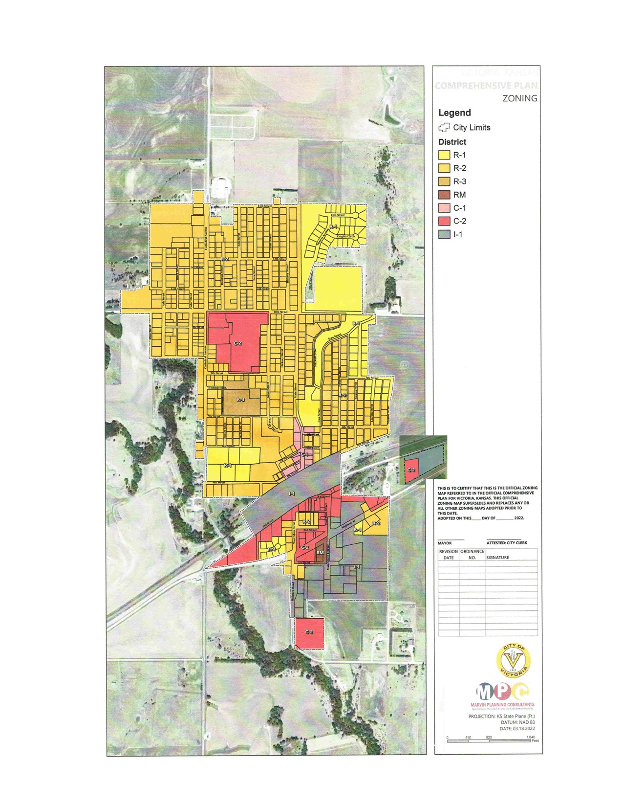
Current Zoning Map (click to enlarge)
*
click here for pdf version of above map
*
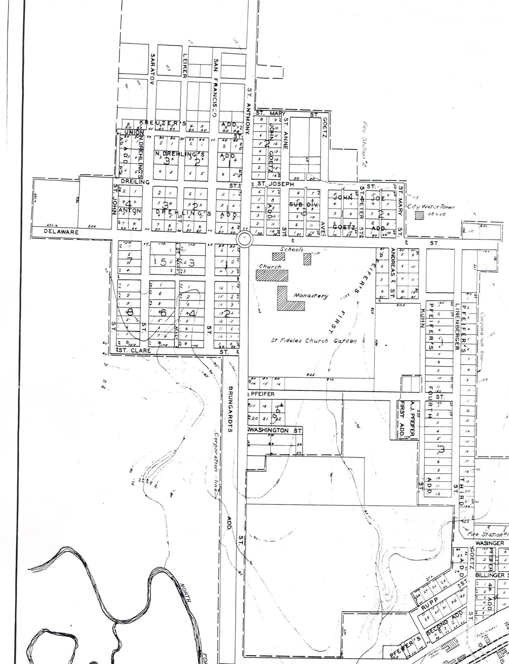
Map from 19?? with original street names
*
click here for pdf version of above map
*
If anyone can add to this listing, please call City Hall
*
Current Street Name
Old Street Name
Highway 40
Highway 40
1st
Unknown
2nd
Unknown
3rd
Unknown
4th
Unknown
5th (east of Main)
Billinger St.
5th (west of Main)
Rupp St.
6th
Wasinger St.
7th
Not Yet a Street
8th (east of Cathedral)
Pfeifer St.
8th (west of Cathedral)
St. Clare St.
9th
Unknown
10th
Delaware St.
11th (east of Cathedral)
St. Joseph St.
11th (west of Cathedral)
Dreiling St.
12th (east of Cathedral)
St. Mary St .
12th (west of Cathedral)
Union St.
13th
Not Yet a Street
Allen
St. John St.
Ash
Saratov St.
Birch
Leiker St.
Cedar
San Francisco St.
Cathedral
St. Anthony St.
Dolorosa
St. Anne St.
Grant (north of 10th)
St. Mary St.
Grant (south of 10th)
Andreas St.
Hickory
Kuhn St.
Main (north of the curve)
Linenberger St.
Main (south of the curve)
Goetz St.
Iron
Not Yet a Street
Jefferson
Not Yet a Street
Kansas
Not Yet a Street
Lincoln
Not Yet a Street
Monroe
Not Yet a Street
Maxwell
Not Yet a Street
Oak
Rupp St.
Washington
Washington St.
Sunset
Not Yet a Street
Skyline
Not Yet a Street
Marc Wagner
Not Yet a Street
Main Street Terrace
Unknown
Ball Park Road
Unknown
West Main
First
East Main
Unknown
Squires Avenue
Not Yet a Street